Showing posts with label Harebell. Show all posts

Wednesday, June 9, 2021

Mackinac Island October 2020

In early October 2020  We took a trip to Mackinac Island for our 43rd wedding anniversary!  We have been going for a stay on the island for a few years now.  This island is part of Michigan and it is very touristy especially in the summer months. We have covered much of this island by biking and hiking including most of the remote parts of the island.  

Transportation is by bicycles and horses on this island except for vehicles like an ambulance, sewer truck, fire trucks, big machines to fix the roads.

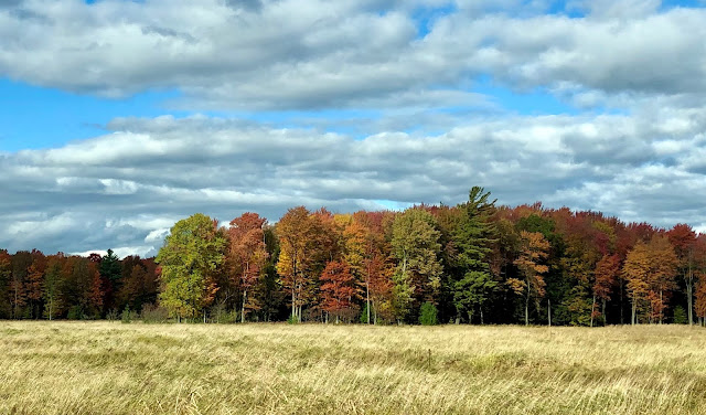
We get to the island by ferry boat which is about a 30 minute trip from Mackinaw City.  In the photo above (taken from  Mackinac Island) you can see the Mackinac Bridge with Lake Huron near us and Lake Michigan on the far side (west) of the Mighty Mac.

We use Star Line ferry service, this is at the dock in Mackinaw City.  
In the photo below you can see the Grand Hotel on Mackinac Island.


   Mackinac Island
  Usually after checking into the inn, we bike around the outer perimeter of the island, about 8 miles.


   Shops on the island


   Arch Rock


 We stayed at the Inn On Mackinac.  Built in 1867.  It is a nice place to stay with a great breakfast and a spa pool, also big porches and lots of flowers.   


     Harebell


We used a special light to look for Yooperlite rocks. 
Yooperlite rocks are actually Syenite rocks that are rich in fluorescent Sodalite.  Using the black light at night on the beach we searched for Yooperlites but found none.  We did have an interesting 4 mile ride back to town in the dark!
It was a fun trip with good weather.  The fall colors were at their peak on the drive up north.


So remember this was last October, it is very green in Michigan right now of course.  Thanks for stopping by.


Thursday, October 4, 2012

Michigan Fall Colors

2012 September 27,28,29,30
A trip to the cabin in Manistee County Michigan.  We walked the Manistee River Trail from Red Bridge to Cedar Creek and back again.  The Fall colors had a good start.  Many trees still had lots of green leaves which made a nice contrast with the reds, yellows, oranges.  It was beautiful.


We thought this was a soccer ball but turned out to be a puffball.


We stopped in at Link's Pond near the weir on the Little Manistee River.  This is a cool place.  And we saw a Harebell.


So the Fall colors are only going to get better, if you can, take a road trip and enjoy Michigan.

Thursday, September 8, 2011

Newaygo

July 25 2011 First stop Brooks Township Hall for info.  We were given helpful information and some maps, we are going to check out Newaygo Coastal Plain Marsh.


Along the way we find High Rollaway Roadside Park, it is situated high above the Muskegon River. 
             234 steps down to the river.


      Muskegon River at High Rollaway Roadside Park


                  A lovely Crown Vetch


There was this six-legged spider on a log near the river.  Is it a Wolf spider?


There was also a Liverwort, it was bigger than the Liverwort we saw at Gale's Pond.

Next we drove to Oak Avenue, a dirt two-track, then west onto E 88th Street.  At this intersection is an Indian cemetery with a sign "Surrerar" also known as Little Prairie Cemetery.
We continued west on E 88th until we came to a more open area we thought would be the Newaygo Coastal Plain Marsh.  Well compared to what we saw on Bing maps this place was grown-in with tall, thick shrubs and trees.  No access here.  We back tracked  to another two-track going north, we pulled onto the grassy verge and parked.  In a booklet this place is called the Coastal Plain Marsh - 88th Street Wetland Restoration Area.
We bushwhacked our way to the edge of the "marsh".  No visible sign of water but the ground was damp, with many rushes and sedges growing there.  After an hour here, it was 80 degrees, we had a cool drink and sandwich in the van.


 East on 88th Street the way we came,  stopping at the


    "Prairie in the Manistee National Forest"


On to the "DNR Forest Area along the Muskegon River" at the end of 72nd Avenue off Thornapple Avenue.  This trail leads you through the woods to the river.

              Indian Pipe
After walking here we drove back to Thornapple Avenue to a boat launch, we just pulled through, we didn't get out of the car.  Then off we went east past the Croton Dam then west again to 72nd Street and now we are north of the Muskegon River.  Here we visit the south end of Karner Blue Nature Sanctuary owned by the Michigan Nature Association.
The prairie was quite dry, not much blooming.

We did find Horsemint still blooming and
Katydids jumping.
In the woods, along the edge of the field, was Harebell blooming.